Leaving some parks takes a long time. Not just the fact that we spent several days at Rainbow’s end but the leaving process itself. To start with, I did lots of research while we were there so I needed to print new lists of possible places to go and things to do. (There’s new stuff on my public park camping list if you’re interested.) Then we had to read the electric meter and pay for the camping and electricity we used. Then we stopped at the book exchange for me to trade five paperback books. Then we stopped at the air hose to fill the left rear inner tire that was low–that was a challenge! In addition to the unusual things like dumping the trash. But, we did, finally, get back on the road.
At one point we came to a three prong fork in the road. The one to the left led to a cemetery. The one to the right led to a different cemetery. We took the middle one. Hopefully, it won’t lead us to a cemetery.
That made me think about headlights. It used to be if a whole string of cars coming towards you had their headlights on, you were witnessing a funeral procession. Now it just means they have their daytime running lights on. I wonder if it’s harder to keep other vehicles from cutting into a procession now?
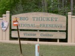
We visited the Big Thicket National Preserve.
This was the first one established in the U.S. back in the 1970s. Apparently the difference between a national preserve and a national park or national forest is the preserve prevents harvesting native trees.
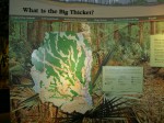
This is one of those places where different ecological systems come together in unusual ways. How many places have you been where you can see pine trees and prickly pear cactus in one park?
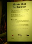
Plus, this park has four of the five insect eating plants found in the U.S.
When we left the visitor center, we passed through the town of Woodville–evidence of the lumbering industry in this area that prompted the establishment of the preserve.
As we drove up the road we saw hurricane symbols painted on the shoulders. Signs say those are Evaculanes–to be used for driving only during an official hurricane evacuation.
I also saw a road that made me think of double vision–County Road 4040.
They’ve been repaving this road and they stuck down those reflectors where the center lines will eventually be painted. Every so often one is not quite in line with the others; it looks like the guy installing them had the hiccups.
Then we crossed Steinhagen Lake to camp in Martin Dies, Jr. State Park, a bird watchers paradise. We got here at 4:45 pm but the clerks had already closed their registers for the day so they gave us a map and said to come pay in the morning. I refused to ask them what time they meant so this morning there was a form on our windshield saying we are supposed to pay by 9 a.m. That didn’t happen. But we will stop and pay on our way out as soon as I post this and finish packing up.
TTYL,
Linda


