Shopping & Stuff

As soon as we got back into our RV after the anti-sway stuff was installed we could feel a difference. Hopefully, it will be enough of a difference to justify the time and money we spent getting it done. We think we will still have some sway when walking around but not any more wind rocking us to sleep and far less sway in the wind on the highway.

Dave has decided to buy a digital SLR camera. Apparently, he’s been researching this for awhile because he knows exactly what he wants and that Best Buy sells them. So, I sat in the RV researching state parks along the Oregon coast while he went into Best Buy. The camera he came back with is much bigger and heavier than I anticipated. So, we talked once again about how much weight we’ve been adding to the RV and that getting our solar system and water tank upgrade may put us over maximum weight.  

Dave’s decided he’d rather have the camera than the piano since he’s finding setting up and taking down the piano to be more of a nuisance than he thought it would be. So, we will be selling the piano. There’s a huge RV gathering in Arizona in January; maybe he’ll be able to find a buyer there. If any of you happen to be along the Oregon/California coast and would like to buy it before then, let us know, please.

In the meantime, we headed west along the Columbia River to the Oregon Coast where we’ll turn south until we need to turn inland again at Florence, Oregon, to get our solar system. That brought us back into the snow zone. It better not!

Then we traveled a stretch of road that felt like the Red Wing, Minnesota area: bluff, road, train, river. When we got up on the bluff looking down at the train it looked like it was Z scale.

We passed a street labeled “Scandinavian Cannery Row.”  Do you suppose that’s lutefisk, herring, and sardines?

Then we pulled into Fort Stevens State Park. Our favorite Oregon park. We spent two nights there so I got to have a day hanging out in my pjs while it rained. I like those days. Especially when we have Ritz crackers to munch on.  Mmmm.

TTYL,

Linda

Running North

I have no idea what possessed Dave when he scheduled four days for a four day trip. Doesn’t he know how slow we travel? For the last four days we got up early, hit the road quickly, drove until sunset, and finally reached Tualatin, Oregon, yesterday for our service appointment this morning.  

Interstate freeway riding is boring so I napped a lot. In between here’s some of what I saw and thought.

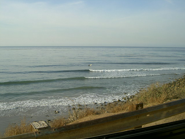
On day one we left before breakfast then stopped along the way and watched some guys trying to learn to surf while we ate.


At Thornhill-Broom Beach there were lots of RVs and tents right on the beach. I must remember this for future use. Once we get our solar panels, we’ll be able to park places like that without giving up any of our comforts.

I saw a tanker truck of fruit juice. We are not in Minnesota anymore. Back there this would have been a tanker truck of milk. I wonder if Californians would find that idea odd?

That switchback on our right up the hill from us turned out to be southbound traffic instead. I’m not used to having facing traffic be on the wrong side of us but road engineers build whatever makes sense in the mountains.

At Vista del Lago there is a Water Education Center. I’d like to stop there sometime but we can’t spare the time to do so today.

Near Gorman there is a rest area with fresh water and a dump. We need to start noticing those if we are going to do much boondocking.

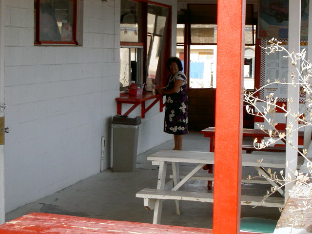
We stopped at a Subway inside a TA truck stop but they had no tables. It’s a good thing we bring our own.

The highway signs say Sacramento and San Franciso are a mile apart. Sometimes one is listed first then the other one is. It feels to me like kids arguing. “I’m bigger.” But, I’m more important.” “I get more visitors.” “But, yours are just tourists, mine are politicians.” “You think that’s better?!”

The tour bus that just went by said USASIA on it. Guess we know who their market is.

We just passed a feedlot. Big feedlot. Huge feedlot. Upwind of us. Dad would take a big whiff and say, “Ah, fresh country air.” He thinks that’s funny.

I just saw a bunch of power poles take off cross country. Gone are the days when you could predict what the road ahead would do by checking out the power poles.

When driving the freeway, it becomes more important to get out and walk at rest areas. No museums to do that in on this trip.

We drove behind a hill about 4:30 p.m. and instantly went from needing a visor plus sunglasses to needing to remove both. I wear my tennis type visor inside when the sun gets too low for the vehicle visor to do the job. I’m sure I look funny wearing it sideways but that’s better than sunburning my ear.

We stopped for the night at San Luis RV Resort in Santa Nella, California.

Our attempt to get away early on day two was foiled by a broken shelf support. Dave emptied the big cupboard over the sink, fixed the shelf, and put everything back differently so I can’t find anything anymore. Keeps life interesting.

Alongside the road are aqueducts–really just big canals. Nothing like the Roman aqueducts.

The farm beside the highway is advertising mandarins and lemons. More evidence we are a long way from Minnesota.

California and Oregon both require you have tire chains available when traveling through the mountains at this time of year. So we stopped at Les Schwab Tire in Sacramento and bought some. More weight to carry.

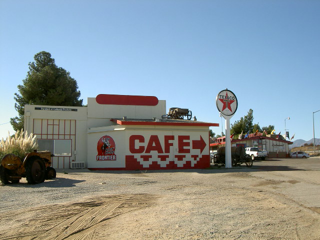
We had lunch at Nick’s Diner on Historic Route 40. Dave says that’s the same road known as the Lincoln Highway back in Illinois. I wonder how much interesting stuff it has along it?

You don’t necessarily need a CB to figure out what the truckers are up to. When all the semis are two lanes left you can bet the two right lanes are going to exit somewhere soon. Or be under construction. Whatever reason they are over there is likely to be a good one so now we move over when they do.

I saw a sign saying, “Sheriff Detention Center”. I guess that’s in case they need to detain the sheriff. I wonder what he did?

We passed a bunch of rice paddies. Are we still in California? I wonder if Viet Nam vets passing here have flashbacks? I don’t think I want to be here when they start seeing everyone as enemy.

There’s a field of fences. Do the grow them here? Maybe they are going to plant grapes on them. Or…?

This night was at Corning RV Park. Good Sam rate of $22 for full hookups.

Today we drove by Richfield, California–shades of the past! Richfield, Minnesota, is where Dave spent his early childhood years along with many other boomers whose parents took advantage of the post war housing boom there. Some of those boomers are moving back now having figured out these small houses are cheaper to heat than McMansions and, with the kids gone, they are plenty big enough. They were big enough before but we were told growing kids need lots of space.

Next to some lush landscaping was a sign saying, “Using reclaimed water.” That says several things about conditions around here.

In Anderson, California, we stopped at the welcome center to get a highway map. Yes, we are just about to leave California but we’ll be coming back in a couple of weeks. This map lists all the parks along the coast highway which should come in handy for our southbound trip next month.

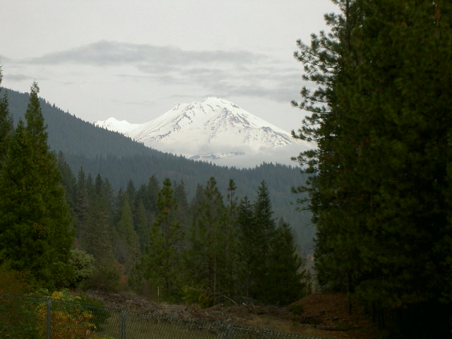
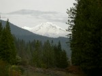
We are now passing through the Shasta Mountains. The leaves on the trees here now look like early October in Minnesota.

We stopped at Vista Point to take pictures of Mount Shasta. I’m glad we don’t have to cross it. Dave says it’s 14,000 feet and we only have to go to 4,000.

We stopped in Yreka at KFC for lunch. Yes, that’s the way they spell Eureka here.

We got up high enough to be driving through the clouds. In spite of the way that sounds, it is NOT fun. Visibility is low enough to be scary.

We finally drove across the border into Oregon on a–surprise–cloudy day.

We spent the night at Joe Creek Waterfalls RV Resort in Grant’s Pass. If you ever stop here, be sure to read the funny story on the back of their brochure.

We woke up this morning to discover we had slept in the clouds last night. Whoever decided to advertise mattresses as like sleeping on a cloud had never done it. They are cold and wet.

I took another one of those water saving early morning showers today. Is it OK that I am getting used to cold showers?

My Coffee Rich was not completely thawed this morning. Crunchy milk on my cereal is not my favorite.

About 9:15 this morning the sun finally came over the mountain and it was like someone turned on the overhead light. From dark to bright instantly.

A place selling ranch fencing had a sign saying, “vinyl is final.” I guess if you are trying to keep stock corralled biodegradable fencing is not so good.

Coyote Jack’s Rawhide Dancehall make me wonder what type of dancing they do that makes their hides raw?

The next sign said:

State Police

DMV – Camping

I guess that would be a really safe place to camp as long as you and your vehicle are in compliance with all current laws.

A billboard asked, “Would your house survive a wildfire?” To which I confidently replied. “Yes, because we would drive ours out of there.”

Last night we stayed at the RV Park of Portland, in Tualatin, Oregon. For a good giggle, check out Freddy Flintlock on their website at http://www.rvparkofportland.com/.

So now we are at Upscale Auto, aka the Sprinter Store, in Tualatin getting an anti-sway bar and adjustable shocks installed. We got up at 6:20 a.m. since the shop opens at 7:00 a.m. It’s now not quite 10:30 and they say we’ll be done in about a half hour. So maybe all that food I loaded into my bag before we came in won’t be necessary.

TTYL,

Linda

Day 35 Route 66

Wow! I went into the library here to exchange books and found a huge collection. I didn’t have time to look at many of them so I just grabbed a bunch and hope they are good ones.

I just saw a local bus. It was turquoise with pink trim. We are NOT in Minnesota anymore.

The Summit Inn Cafe was our first stop this morning. Based on its name I expected something like the lodges in the Glacier National Park. Nope  It’s fine for what it is; it just isn’t what I was expecting.


Cajon Summit is the oddest summit I’ve ever seen. First, you start from the Mojave Plateau so you don’t climb much to reach it. Then you start going down 12 miles without going over the mountains you see in front of you. In fact you never go over those mountains; you go between them. So you don’t ever feel like you reached the summit.

At the bottom you turn onto Foothill Boulevard and drive forever. It is hard for me to write foothill as singular as if there’s only one but that’s the name of the road. Here’s a view from the boulevard.

Our first stop on Foothill Boulevard was Bono’s Historic Orange. I’m sure that’s not what it was called back in the day when someone spent the day inside this thing selling orange juice. I’m not sure why they don’t still do that, though. 

Our next stop was REI, where we picked up a month’s worth of freeze dried dinners/deserts. That was one BIG box. Fortunately, a clerk offered to carry it out to the RV for me. He was impressed with our little house.

Our next stop was the post office where we picked up our regular mail plus another new Segway seat. There was a really helpful clerk there who opened the General Delivery pickup window just for us. He was funny too. He made me swear that box was really for me.

While looking for the next Route 66 museum we stumbled on another beverage container recycling center so Dave got rid of our bag of cans and got a receipt that could be cashed in the store for $2.99. We are not used to being paid to recycle. We needed to buy a few things so Dave went in and collected.

We never did find that museum. There is now a winery/BBQ place at that address.

We did find the Sycamore Inn which has been there since 1848. The trees made it hard to get a good picture but you can see it looks more like the lodge I expected the Summit Inn Cafe to be.

We had planned to eat at the Buffalo Inn where I could have another Buffalo Burger but we never found it. We found a sign for what I think was their overflow parking but not the restaurant.

Then we stopped at what we think was the Claremont Griswold Center. It didn’t exactly match the address we had but it was at the right intersection and it did meet the description of an old school. I suspect this was one of the places where white men tried to “civilize” American Indians. It is now a business center that is being renovated.


Then we went looking for the Fairplex RV Park. Again the address we had wasn’t right. The GPS said we passed it so we took the next right and found the entrance to the fair grounds. A guy there gave us correct directions so here we are, safely tucked in elbow to elbow with lots of other RVs with time to do laundry and unpack that big box of food.

TTYL,

Linda

Day 34 Route 66

Dave finally persuaded me we can go north instead of south when we finish Route 66 in a couple of days so this morning he made appointments to get our solar panels and our anti-sway system installed in Oregon starting next week. Now we have deadlines to keep us moving. Still, by the time we got all that done, we didn’t depart Newberry Springs, California, until 10:45 a.m. 

Today’s train comment is about locomotive maintenance. The stack train had two shiny BNSF locomotives and a very dirty Union Pacific one. Does the BNSF not maintain borrowed power? Do they just want to look better than their competitors? I wonder why the difference?

There appear to be two items being harvested in this part of California. We went by an orchard with signs advertising pistachios for sale. Then we went by a field of solar panels with major power lines leaving it. I highly approve of harvesting the sun. We should be able to do that ourselves soon.

In Barstow, California, we stopped at the regional Bureau of Land Management office to see if we could get clarification about annual permits. The answer is no. Apparently each region is totally separate from the others and this region doesn’t have any permits other than charging $6 to stay in their official campgrounds. You can boondock (park off the road without any hookups) for free anywhere around here.  I expect to do more of that once we get our solar system.

Then we drove by the El Rancho Motel hoping to get a good picture of their sign. That didn’t happen either. A chinese restaurant has co-opted part of the sign which totally ruined the effect. And the really big sign way up in the air was backlit by the sun so that picture didn’t come out.

Then we went to the train depot hoping the Route 66 Mother Road Museum there would be open even though the literature said they wouldn’t be. They weren’t. But we did get these pictures of the former Casa Del Desierto Hotel, another former Harvey House.


Then we went to the Flying J and got fuel for the RV and for us. We spent time in their restaurant trying to blend my list of stops with Dave’s list of turns in the route. That should make things a little easier for me as navigator. Trying to bounce back and forth between the two lists has become too frustrating.

We passed a sign that said, “Buckboard Road” which made me wonder if the wagon seat known as a buckboard got its name from it trying to buck you off. We’ve been on some roads lately that tried to buck us off and those were “improved” roads.

We got to Victorville, California, in time to actually get into the California Route 66 Museum. They had a bunch of cool stuff including this teardrop trailer that was built by one of their board members from old plans. You used to be able to buy a kit to make these so the guy decided he should be able to build one. Inside the main body is all bed with a shelf at the head and a cupboard at the foot. The back hatch opens to reveal a kitchen.  Cool, huh?


We also saw this sign at the New Corral Motel. I’d like to see these neon signs all lit up at night but we like to be in camp and all hooked up by sunset so seeing them lit is not likely to happen.

We needed groceries again and there aren’t any WalMarts around here so we stopped at Stater Bros. in Hesperia, California, instead. They had a beverage container recycling center in their parking lot so we thought we were going to get rid of another bag of cans. But California refunds deposits on cans so the place is only open when it is staffed. Guess what? Right.

So now we are in the Desert Willow RV Resort in Hesperia where I plan to exchange my books before we leave. I hope they have some good ones here.

TTYL,

Linda

Day 32 Route 66

We started the day today at a T/A truck stop in Kingman, Arizona. We wanted to fill with diesel before we hit California gas taxes and we weren’t sure what we might find along today’s route. Plus we wanted to weigh the RV to be sure we could still carry the solar panels we want to get. Unfortunately, we arrived at the truck stop about the same time as three busloads of tourists so everything took longer than usual. It’s a good thing we don’t have to keep to the type of schedule the truckers do. And it looks like we can still get two solar panels with the accompanying gear without going over our weight limit.

Then we set out on Route 66 headed to Oatman, Arizona. We’d been warned that RVs over 30 feet shouldn’t try this road. We saw a sign that said trucks over 40 feet were forbidden. We knew that meant a steep and winding road was ahead of us. We saw signs saying “Do not enter when flooded” where the dry washes crossed the road. But we went anyway. You’d think after having driven Alkalai Road in the Bighorn Mountains and refusing to take a road around Dead Man’s curve we wouldn’t risk taking this road. But we did. We took it slow and easy. We pulled over for for other vehicles we met or who wanted to pass. And we climbed that narrow, twisty road to Oatman. Where we met a tour bus. Apparently going down the other side would be easier.

Oatman has two claims to fame: The old Oatman Hotel and the burros that wander the street sticking their nose into anything they think might contain food. The street is narrow and full of burros and tourists and the shops along the street now cater to those tourists but everyone ought to go to Oatman once to see the burros.


Just through town, before heading down the hill, Dave decided to try our antenna system again. When he pulled over we each had three bars on our cell phones. He plugged in the antenna and we each got five bars. The antenna/booster works! The Sprint air card we use to get Internet, though had no signal to boost so we still don’t know if that part works.

Once we got down the other side of that mountain, we crossed the Colorado River into Needles, California. Lunch was high on our list of things to do next so we stopped at this Burger Hut for lunch. We are in California where the dining room is open to the air and where most people like their food spicy. We decided we’d order our burgers plain and add our own seasonings in the RV. The cook was offended that we wanted them plain. I explained we had our own sauce. Then he came outside and saw our RV smiled and said, “Perfect.”


This is the El Garces Hotel in Needles, California. It was built as a Harvey House along side the Santa Fe railroad. It is about to be restored to its previous grandeur.

We pulled into the Desert View RV Resort without a reservation. We have made no reservations anywhere so far on this trip. When we told the greeter we’d like to stay two nights she looked worried then said she’d see what she could do. She found one spot. They have a rally coming in this weekend and some of the people are coming tomorrow but some aren’t coming until the next day. So as long as we promise to leave before the others come we can have this spot.  

So, we are settled here for the next two nights. The spaces are close together but they have oleander hedges and trees between them which keeps you from looking into your neighbors windows. It doesn’t keep you from listening to their conversations though. Be careful what you say.

TTYL,

Linda