It feels like forever since I posted an entry but it has only been two days. I guess they’ve been very full days. Let’s see what my notes say we’ve been doing.
When we departed Usery Mountain it looked like it was snowing on Hwy 60 in Phoenix! It was just pieces of styrofoam blowing in the wind, though.
We stopped at REI and stocked up on freeze dried food then headed south on I-10. The next thing I know a sign was warning “Blizzard conditions ahead!” Snow after all? No, it was an ad for DQ.
We stopped for the night at Picacho Peak State Park still in Arizona. Cool place. $20 for an electric hookup. Spaces placed so your neighbors didn’t feel like they were in your lap. A Civil War Reenactment we didn’t see because it’s next month. And hiking trails we didn’t hike including one that recommends wearing gloves to grip the cable that helps you climb Picacho Peak.
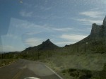
It’s a nice stop right along the highway but far enough from the road for the highway traffic sounds to be white noise. We’ll come back here, I’m sure. Next time I’d like to do some trails. Not the one with the cable, though.
While in the park Dave heard a cat. Around here outdoor cats are called coyote food. If you come here, don’t bring any cats that like to escape the confines of your vehicle.
As we passed Tucson I saw a roach coach type food vendor except this one was built on a golf cart! I guess that makes sense since I saw it on a golf course.
Along I-10 there was a sign that said, “Mowers Ahead.” My first though was, “They mow cactus?” The answer turned out to be, “Sort of.” They had some machine they placed over small trees and it chewed them up. Reminded me of the movie Fargo.
Another sign: “Diesel Deli.” It made me laugh then I realized it could actually mean what it said. What type of diesel would you like today? Farm diesel? Low sulphur? Ultra low sulphur? We have it all.
We stopped for a night at the Escapees’ Saguaro Co-op in Benson, Arizona. The sign at the entrance said they were full except for boondocking but when Dave went in to register they said they have one spot with hookups that can only take short RVs so we got full hookups.
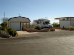
We knew ’08 classmates Mike & Julie were supposed to be in the park somewhere but they posted on the forum that they were going to Mexico for the day. Not knowing what happens when a call bounces outside the U.S. we decided not to try calling them on the phone. Instead we posted a message that we were in the park, too. I didn’t get their reply until the next morning just before we headed out so we missed seeing them but we did talk by phone about where we are headed and the likelihood we would meet up again along the road. I would have liked to stay another day to see them and maybe Dave K. who was headed that direction. But the weather forecast is for windstorms with rain the direction we are headed so we decided we needed to keep moving.
Leaving Benson the sign gave the mileage to the next town then the mileage to El Paso, Texas, as if New Mexico is not between the two. Hmmm. Some rivalry there maybe?
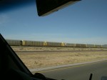
On the track beside the road was a unit hopper train with smoking coming from it about half way back from the engines. We paid close attention thinking maybe we were going to see a hotbox. What we saw was one hopper gate open a little bit spilling rocks along the way. Dave’s theory is they were replenishing ballast.
We stopped at a rest area where a vending machine started calling to me. “Linda. Come over here. We probably have something you’d like.” Now, I’ve been trying to eat more healthful food. Instead of cookies and chips we’ve started buying graham crackers and fruits and nuts. I’m enjoying eating those. But that darn machine just kept calling. So, I bought a small bag of Cheetos. I didn’t eat them, though. We were too close to one of my favorite lunches.
We saw a sign advertising a place called Phantom Fireworks. Dave asked, “Do they really exist?” Which we thought was really funny until we got to the places and it was closed. Then it was even funnier. I guess you had to be there.
We keep passing sets of signs warning of possible dust storms which could have “Zero Visibility” and warning you to not stop in traffic lanes. I guess it’s a good thing we keep moving without stopping at the sites along the way since the winds are supposed to hit here before the rains do. Mike and Julie are planing to travel this road a day behind us. I hope they don’t get into one of those wind storms.
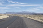
The speed limit on this stretch of road is 75. I saw the sign and looked at Dave with a smile. He smiled, too, and said, “I’m going a dyslexic 75.” We get better mileage going just under 60 mph so that’s what we do. Unless we are going slower than that. In one construction zone the speed limit was 65 but we decided we didn’t have to go that fast there either. Which was good because it dropped to 55 shortly after that so even we had to slow down for that one.
About a half hour west of Deming, New Mexico, we passed what appears to be a railroad storage yard. One track had auto racks, one had tank cars, and one had hoppers. All just parked out there in the middle of nowhere. That could make an interesting model operation. A through train could stop and drop cars not needed elsewhere or pick up cars that are now needed. It’s seems likely to me that the drop off could be a mixed cut that needed to be sorted but the pickup would likely be all of one type.
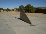
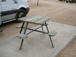
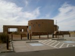
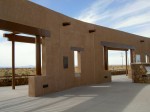
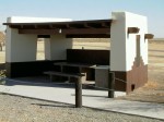
We stopped at a rest area in New Mexico that had interesting picnic shelters.
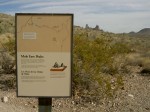
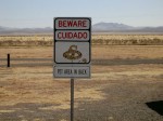
And an interesting definition of pets.
There was a billboard that said “Follow the zipper to yardstick 102.” I thought about that one for awhile. The graphics indicated the zipper was the dotted line down the middle of this side of the divided highway. So it’s likely the yardstick is a mile marker or exit number. They could have just said that. Of course, then I wouldn’t have spent as much time thinking about it. I still don’t know what was at mile marker 102, though.
Some of the shops along here do too much advertising. These are “trading posts” with each sign advertising a set of items. One for jewelry. One for moccasins. One for products made from cactus. One for rugs. One for ponchos. One for moccasins. One for snakes. One for leather goods. One for a free hot dog with a tank of gas. By the time I’ve read all the signs all I can think is, “Tourist trap.” So we don’t stop. Not many other people do either. That last one had two cars out front and a small U-Haul truck at the gas pumps.
In Deming, New Mexico, we spent the night at the Escapees’ Dream Catcher RV Park. This one is not a co-op; it’s just an RV park—basically a gravel parking lot with just enough trees to make you pay attention when you are trying to park. They had a nice laundry though so we have clean clothes again. They also had what was probably a nice potluck but I didn’t go in with Dave to register so I didn’t see the notice. It didn’t even occur to Dave to mention it to me. So the first I knew about it is when I saw people heading to the clubhouse carrying crock pots. I guess I’d better start going in with Dave if I want to know what’s happening.
In Las Cruces, New Mexico, we stopped at the BLM District Office to get a map of their territory. I went in without Dave this time. They charged me $4 for the map of New Mexico. I had to go back out to the RV to get money. I liked the Yuma office better; they gave Dave two maps for free. Hmmm. Maybe I’m not supposed to go in.
Billboards on opposite sides of the highway advertised different places at Exit 0. One said 9 miles and the other said 11 miles to the exit. I wonder if their surveyor is the same one who did the original survey of Dave’s Dad’s property on Lake Milacs which resulted in everyone building their boathouses on their neighbor’s property?
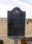
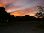
We pulled into Hueco Tanks State Historic Site about 3:30 this afternoon. The sign said the park was full but we were welcome to come in and put our name on the waiting list. I decided to go in anyway to see where they recommend we go and to buy an annual Texas State Park Pass which will save us money on admissions. It turns out the campground is not full. What they ran out of is permits to hike in this historically important but fragile place. So as long as we don’t go see the pictographs, we can stay here tonight. We have a nice campsite with electricity and water and a beautiful sunset.
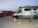

And the reason it feels like it’s been longer than two days since I posted is that I was already two days behind then. Sorry, this one is so long. I didn’t even include everything from my notes and look how long it is. Is this a case of “The hurrier I go the behinder I get”?
TTYL,
Linda

