How Exciting!

We got to spend some time outside today meeting some neighbors.

It sure was a noisy experience, though.

The building fire alarms went off, all the fire doors closed, and I got to prove I can walk down two flights of stairs. Carrying our bug-out bags just in case this was real. And worrying about our car being parked in the underground garage.

Then a fire truck showed up. Only one, though, and they didn’t seem to be in a hurry so we thought it was probably a false alarm.

Not.

It seems someone near the center of our building had a small kitchen fire.

Made me glad we have fire extinguishers in case that ever happens to us.

And that I can still walk down the stairs.

Sorry about no photos. That was not what was on my mind until we got safely back inside.

TTYL,

Linda


Improved sleep

Being under the impression that I am sleeping better I decided to use my FitBit to check it out.

Time it took me to go to sleep: 6 minutes. Times I woke during the night: 10.

Those feel like good numbers for me.

So, imagine my surprise when I went back and looked at my weeky averages for those weeks I measured my sleep and found those number to be typical.

It’s all perception, people.

All of life is just perception and interpretation.

TTYL,

Linda

More GPS

We’ve been asked to post as much as we are willing to do about our new GPS for the benefit of those in the market for a new one. So here’s today’s trip.

We live in a suburb on the west wide of Minneapolis, Minnesota. Today we had several errands to run which included a stop at our favorite Denny’s which is far from home but on the way to the outlet mall which was one of our destinations for today. So, after making the close to home stops, Dave entered Denny’s as a name search. But this GPS only finds points of interest that are fairly close to where you are at the moment and we weren’t close enough for it to find it. Since we knew it was near the intersection of I-94 and Hwy 101, we put those as the cross streets in the intersection search and it found that.

Normally, from where we were at the time, we would have backtracked to the freeway and taken a couple of them to Denny’s. But, our GPS took us on a pleasant drive through the country on two lane roads and past a KOA we’ve stayed at many times so we arrived unstressed by the drive. Nice!

When we were ready to leave Denny’s we wanted to enter the outlet mall as our next destination but we weren’t sure of the name of the mall. No problem. There is a POI section for shopping so I chose it then selected shopping mall as our category. And it found the one we wanted in a town about 6 1/2 miles on down the road.

We are enjoying using this GPS in territory that is familiar to us because it is helping us learn how to use it when I get into unfamiliar territory. And Dave likes it so well he is talking about buying one for him to use in the car when I take this one with me in my RV.

I don’t know how we can recommend it any higher than that.

For those of you who might be just tuning in it is a Garmin dēzl 560LMT and, if you search this blog for that term, you will find my first review of it with details of using it in following blogs.

Happy travels.

TTYL,

Linda

Texas Trip, Day 7

Walked out of the motel this morning and thought about jackets. How long has it been since I last thought about wearing a jacket outside? Then again, how long has it been since I was outside at 8:20 am? The hours I’ve been sleeping this week you’d think I had to get up and go to work in the morning. Is riding in the car work? I’ve been doing it for most days from about 9 to 5 for a week now. I wonder if I’ll stay on this sleep schedule when we get home. Wouldn’t it be odd for us for me to go to bed and get up before Dave?

We learned more about our GPS again. Last night Dave used the “trip planner” feature to plan today’s trip. It will now lets us list rest areas without actually stopping at them. Yay! Plus, using that feature adds items to the end of the list instead of the beginning so you don’t have to drag to sort. It also offers an optimize option so, if you add things out of order, it will resort them for you. This GPS  just keeps getting better and better.

False advertising? Only sort of. When you enter Iowa from the south on I-35 the first rest area is at mile marker 7. The state has it’s official welcome center at this rest area. But, as you approach exit 4, three miles before the rest area, you will see a blue & white information sign telling you there is a Welcome Center at exit 4. And there is. Run by the local Chamber of Commerce. Do they offer free information about the state? Yes. Do they have public restrooms? Yes. Do they have a cafe? Yes. Is their status ambiguous? Yes.

Des Moines exits are confusing. In this part of the country the exit numbers match the mileage markers on the highways. But Des Moines has too many highways passing through it. At one point I-80 and I-35 run together. So exit 125 and exit 72C are right next to each other. If the gas station and the restaurant are one each at those two exits would YOU expect them to be one right after another?

There used to be a Flying J station just north of Des Moines but we couldn’t find it this trip. So I went on-line to their website and discovered there’s now one in Williams, IA. That was in reach on the current tank of fuel so we headed on there.. Guess what? No station. A bulldozer and a pile of rubble under the Flying J sign. At least it was was easier for us to do a u-turn than it was for the semi ahead of us that planned to stop at that same station. Why do websites not keep their listings current? Especially those wanting semi-truck traffic. I sure am glad we were not in our former Class A RV towing a car. It’s a long way around the block out here in farm country.

Do you remember me telling you about the two car symbol on our GPS that changes color? I though it was telling us if we were in the right lane or not. I guessed wrong. It is a traffic density indicator. It is construction season here in the Midwest so we are having intermittent lane closures. There are no traffic cameras where the work is being done so our GPS assumes traffic is backing up in those reduce speed and reduced lanes areas. Fortunately, it has stopped trying to route us around them on roads that would actually take longer than the minor slowdowns we are experiencing. It’s not a perfect world, even in our GPS.

When we were full-time RVing I kept a pencil and small notebook by the passenger seat so I could make notes on things I wanted to remember to blog about when we reached camp. On this trip, I’ve kept my iPad handy and am writing as we go. It’s very challenging. Where will the bouncing finger land and what will the result be? Once it hit something that made an entire blog disappear. Fortunately, I was able to use my browser’s back button to find it still existed. Each evening I spend time correcting all the errors before posting that day’s blog. Dave reminded me I won’t be able to do either type of writing when snowbirding. Guess I’m going to have to learn to dictate into a recording device.

Boy, that comment took me a long way back. I studied shorthand in high school. I learned more about punctuation in that class than I did in any English class. But, if I’m dictating to myself do I have to include all the punctuation and everything?

I don’t usually talk about politics but this is more about my zany brain than it is politics so I decided to share it. I saw a clip on TV where Romney introduced Ryan as “the next President of the United States.” Which made me wonder what Romney is not telling us. Is he planning to win the election but die before inauguration? Just in case it happens that way, remember, you heard it here first.

HOME! Collapsing now.

TTYL,

Linda


Texas Trip, Day 6

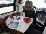
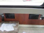
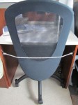
Here’s another reason we like Comfort Inn: outlets. Lots of them. Fairly accessible. Each night we plug in two computers, one iPad, and two cell phones. It’s nice to not have to crawl behind furniture to be able to do that. Comfort Inn rooms have desks, too. With real office chairs. And the lamp on the desk at most of them has at least one outlet right in its base so it’s easy to plug in your computer and go right to work.

I’ve been playing with some more features of our GPS. Today we are experimenting with listing multiple potential stops. I want to know what happens when you don’t stop as well as what happens when you do.

I decided to start by entering rest areas. In the POI section under the trucking information I found a list of rest areas. This list basically starts with your current location and goes out from there in all directions. So you need to have an idea of what direction your road heads. For us today, that is north. So I just scrolled through the list and selected each stop that said it was north of me.

Next I went to the truck stop section to select fuel stops. We like Flying J and there were some of those on our route so I selected a couple.

Then I entered the motel we are shooting for today. I already had an address for it so I entered it directly. You start with the state. If you will be stopping in the current state you don’t have to do anything. If not, you enter the first few letters until it brings up a list. I only had to enter “Mi” and it gave me a list to choose from and I selected Missouri. The city then works the same way. Then you enter the “house” number and touch “done.” Then the street works like state and city.

Unfortunately, it puts all that on the list in the order you entered it. But each entry has an arrow you touch and drag to move it to the correct position. Touch “go” and you are ready to head on down the road. Unless you are sitting inside a building where there are no satellite views. Then the GPS will give you the choice of previewing the route. So you can do a dry run to get familiar with what will be coming up when you do move. Another nice feature.

For future reference, when I will be carrying my own facilities, I noted the GPS did not have parking only rest areas. I wonder if they are named something else on it? Have to look further into that.

But, I did get an anwer as to what happens if you don’t stop at an intermediate place on your route. A rest area we planned to stop at was closed so we couldn’t stop there. That meant the GPS thought we just missed our turn. It tried to get us to turn back at the next  four exits before I got tired of listening to that and started a new route instead. Maybe next time, we’ll pull off on the shoulder and stop to see if that is enough to make it happy again.

And when you do stop? It directed us right to the Flying J then promptly asked us to “Proceed to the highlighted route.” Which we did only after getting fuel first. So that part worked fine.

We just passed by a town whose name I didn’t catch. They are advertising their growth. But, I’m a little concerned about their city planning. What I saw was a cul-de-sac with a telephone pole in it. Not centered in it, either. Mentally draw lines bisecting the circle both north/south and east/west. Now follow that east/west line about halfway between the north/south line and the outer edge. Plant the telephone pole there. Now drive your semi-truck around the circle to go back the way you came. Challenging? You betcha! 🙂

We’re approaching Emporia, Kansas. There are two logical routes from there through Kansas City. One, first pick of both our GPS and Google Maps, is to stay on the Kansas Turnpike to Tulsa then turn east and take the outer loop around KC. The second is to exit the Turnpike to stay on I-35 and go right through downtown KC. According to Google Maps, the difference between the two routes is three miles. The shorter path takes three minutes longer. Since today is Sunday there is no reason to avoid downtown. But, there is always a reason to avoid paying extraneous tolls. So we’ll stay on I-35 and see how far we have to go before our GPS quits telling us to turn around.

It did well. By the time we paid the toll, and we had exact the exact amount out and ready,  it had already changed to match our chosen route. Way to go GPS!

If you ever find yourself in Kearney, Missouri, just north of Kansas City, anywhere near meal time be sure to go to the Stables Grill on the southwest corner of exit 26 off I-35. We ate there this evening and it was wonderful! I wasn’t particularly hungry going in but I ate all my Chicken Marsala and vegetable medley, about 1/2 the big pile of mashed potatoes and somewhere between 1/4 and 1/3 of Dave’s carrot cake. His club sandwich was huge and he ordered potato salad to go with it. All that for about $25. One of the staff told us the carrot cake is made from scratch by the head chef’s mother and I believe it. And I believe this small town cafe has a chef not a cook. And I love that the dining room is smoke free but the “tavern” isn’t. Since you go in the main door then turn one way or the other to go through doors into totally separate areas there is no spill-over air pollution. When you go, you’ll thank me.

TTYL,

Linda